-40%
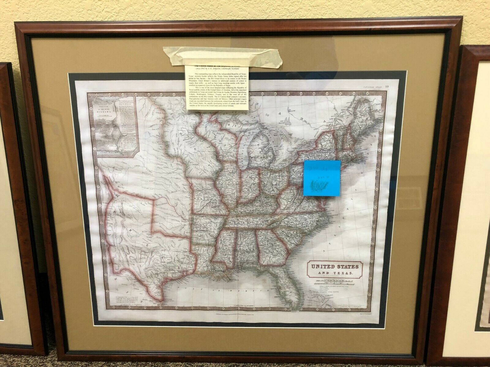
The United States and Texas
$ 81.31
- Description
- Size Guide
Description
The original sale price is 0 plus tax on the website below.https://galleryoftherepublic.com/product/the-united-states-and-texas/
Description
This outstanding map includes a wealth of information on both the independent Republic of Texas as well as the 26 States “Back East”. The Western border of Texas had been established by treaty as “the Rio Grande River to it’s source….” as recorded on this map. In the lower left corner of this map is this important notation:
“The Independence of Texas was formally declared in March 1836. It was recognized by Great Britain in November of 1840 and has been acknowledged by the United States, France, Holland and Belgium.”
This is one of the most detailed maps reflecting the Republic of Texas and the whole of the United States of America. All of the important settlements in Texas are noted: San Felipe de Austin, Houston, Harrisburg, Liberty, Washington, Velasco, Texana, and to the west all of the settlements on the Rio Grande. The El Camino Real connects Louisiana, Nacogdoches and San Antonio with old Mexico. Other principal wagon roads are recorded between the settlements inland from the Gulf Coast. In the United States, the rapidly developing system of canals and railroads reaches as far west as the Great Lakes and central Indiana.
